
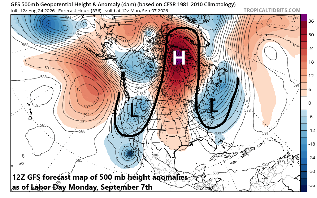
There are hints of an “omega” blocking pattern in the upper part of the atmosphere as we approach the Labor Day weekend with an intensifying ridge centered over north-central Canada and troughs of low pressure over the NE US and NW US. Map courtesy NOAA, tropicaltidbits.com
Overview
Labor Day is still two weeks away and that puts this outlook in the “speculation” phase; however, there are interesting and somewhat consistent signs of an “omega” blocking pattern in the upper atmosphere over North America which is more typical of winter or spring. An “omega” blocking pattern typically features an upper-level ridge sandwiched in between two upper-level troughs and these systems tend to linger for several days. If indeed this pattern unfolds with an upper-level trough over the Northeast US, then any chance for sustained heat for summer’s unofficial end would be quite low.
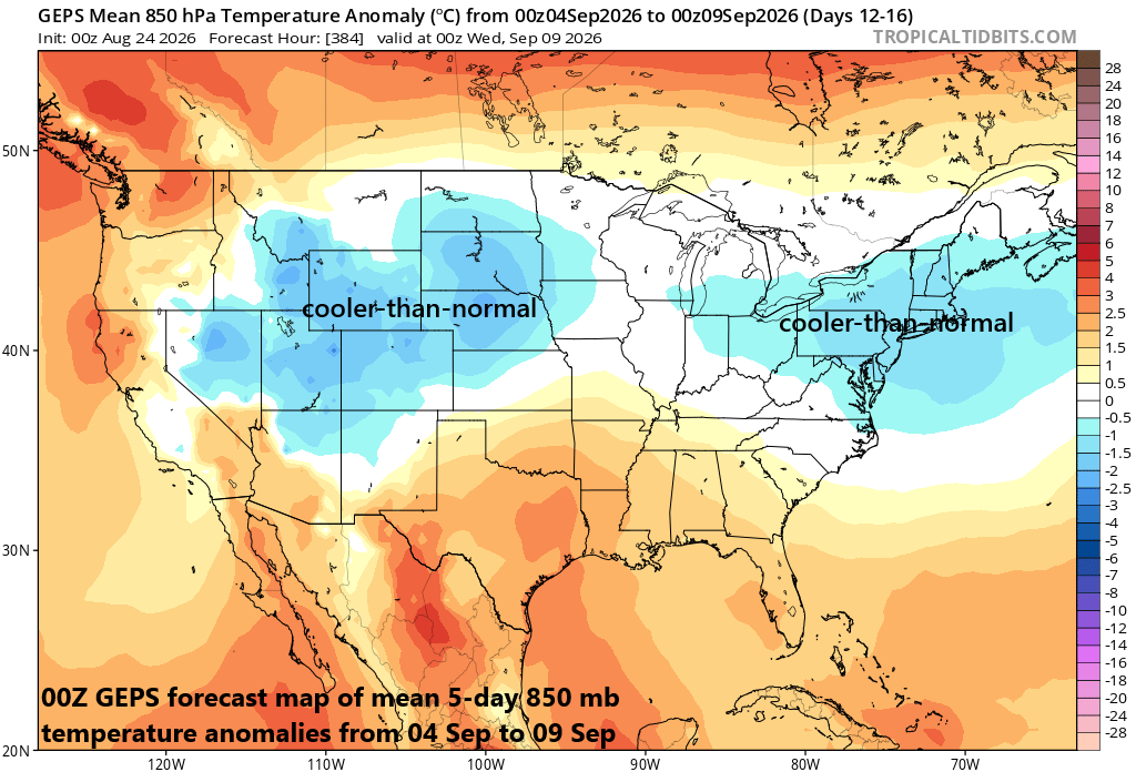
If an upper-level trough sets up over the NE US and NW US in early September then cooler-than-normal conditions could be the result for a several day time period. Map courtesy Canadian Met Centre, tropicaltidbits.com
Details
Labor Day comes late this year and is still two weeks away from today, but many are wondering what kind of weather there will be in the unofficial ending to the summer season. Some computer forecast models hint at an “omega” blocking pattern in the upper part of the atmosphere, which is more typical of winter or spring, but cannot be ruled out for early September. In this potential scenario, an upper-level ridge is projected to intensify over the north-central part of Canada and be sandwiched in between two upper-level troughs of low pressure with one centered over the Northeast US and the other near the Pacific Northwest.
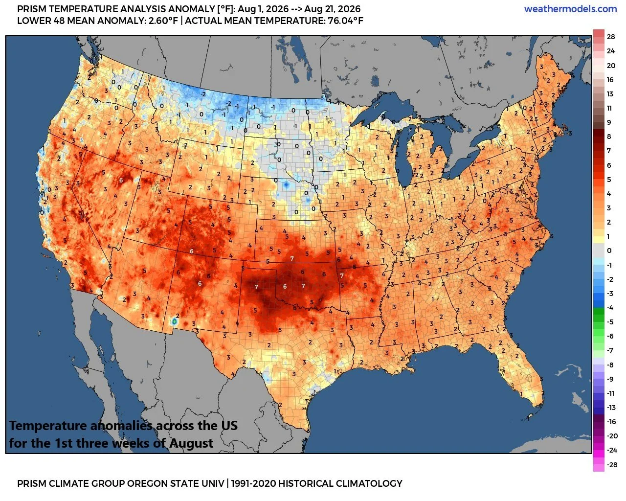
The month of August has been warmer-than-normal across much of the nation including across the northeastern states, but that pattern could change in early September if an “omega” block sets up with upper-level trough centered over the Northeast US. Map courtesy NOAA, Prism-OSU
If this type of pattern unfolds, then cooler-than-normal conditions would be possible across parts of the northern US; especially in the Pacific Northwest and across the northeastern states. In addition to potential effects on temperatures for the Labor Day weekend, another interesting facet to monitor in coming days would be potential impacts of a western US trough on tropical moisture associated with eastern Pacific systems. One possibility in this active tropical season across the Pacific Basin will be the influx of tropical moisture into the SW US and a trough of low pressure could help to “absorb” some tropical moisture during that first part of September…all in the speculation phase but something interesting to monitor as August winds down and September gets underway.
Meteorologist Paul Dorian