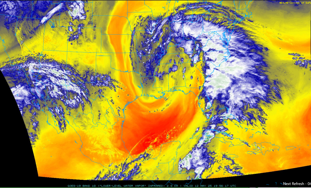

A plume of tropical moisture on Monday extends from the southeastern Gulf/Caribbean Sea to the Mid-Atlantic region (low-level tropical moisture shown in blue/white colors). Map courtesy NOAA, College of DuPage
Tropical moisture us flowing northward along the eastern seaboard and it is supported by a slow-moving and vigorous upper-level low pressure system. The result will be an extended period of showers and thunderstorms that should get underway late tonight and continue through Thursday. While there may be a brief break in the action after the upper-level low finally exits off to the north and east late this week, another system will push into the Great Lakes and it’ll send a couple of frontal systems into the Mid-Atlantic from late Friday into Saturday. These fronts will renew the chances for showers and thunderstorms at week’s end and to start the upcoming weekend and some of these storms can reach severe levels in the Mid-Atlantic region.
This wet pattern will no doubt wreak havoc on big-league baseball games in coming days especially in Mid-Atlantic cities likely Philly, New York and Baltimore where there are games scheduled. In terms of temperatures, there will continue to be colder-than-normal air masses moving into the US in coming weeks either from Canada into the central and eastern states or into the western US from the (chilly) eastern Pacific where water temperatures are generally below-normal. As a result, the “home Run Forecast Index” will very likely continues through the month of May with high Index games and low Index games…much as has been the case in recent weeks.
Meteorologist Paul Dorian