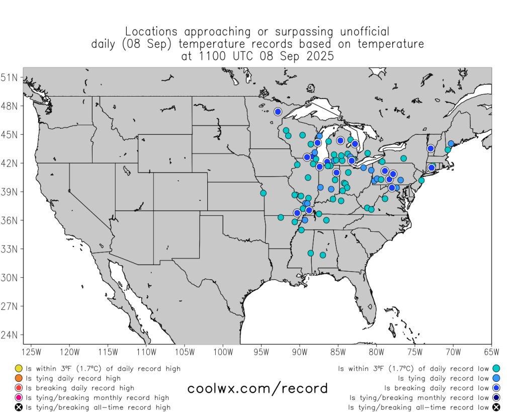

Numerous record lows or near record lows on Monday morning across the Upper Midwest, Ohio Valley, Mid-Atlantic and Northeast US. (Map courtesy NOAA, coolwx.com)
A widespread chilly air mass for this time of year has reached the Mid-Atlantic region and Northeast US on Monday, September 8th after getting “hung up” for awhile in the Northern Plains, Upper Midwest and Great Lakes. As a result, there will be some very low “Home Run Forecast Index” games during the early part of the week in places like Cleveland, Ohio, New York City and Philadelphia. The “Home Run Forecast Index” is displayed on a scale of 1-10 where 1 represents the most unfavorable weather conditions for the ball to carry and we’ll have HRF Index values close to or equal to 1 in some spots across the northeastern part of the nation. There were numerous record lows or near record low temperatures set on Monday morning including several places in Pennsylvania such as State College, Altoona and DuBois. There can be a repeat performance of this type of record-breaking results on Tuesday morning across the northeastern states. Looking ahead, there are 3 weeks to go in the regular season and then the month of October will be filled with playoff baseball…and very likely…some additional chilly air outbreaks.
Meteorologist Paul Dorian