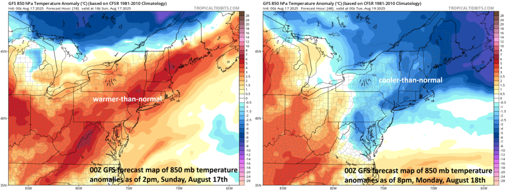
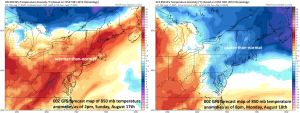
A strong cold frontal passage will bring significant temperature changes
to the NE US between today and Monday (Map courtesy NOAA, tropicaltidbits.com)
A strong cold front will push through the northeastern states on Sunday night and it’s passage will bring about big-time temperature changes in many places. In Boston, for example, high temperatures later today will likely be in the middle 90’s with the chance of PM showers and thunderstorms. On the back side of the front on Monday, temperatures will struggle to reach the 70 degree mark and there will be a stiff northeast wind as well in New England. As a result of the drastic temperature change, the Home Run Forecast Index will change from a “10” on Sunday afternoon to a “1” for Monday night’s change. A “10” represents weather conditions that are the most favorable for the ball to carry (i.e., for hitting HRs) whereas a “1” indicates least favorable conditions. Check out our premium site at premium.homerunforecast.com to get the stadium-specific forecast data and Home Run Forecast Index values for all of today’s games and tomorrow’s games…just $5.99 per month…get the weather-based tool for the stretch drive and playoffs.
Meteorologist Paul Dorian