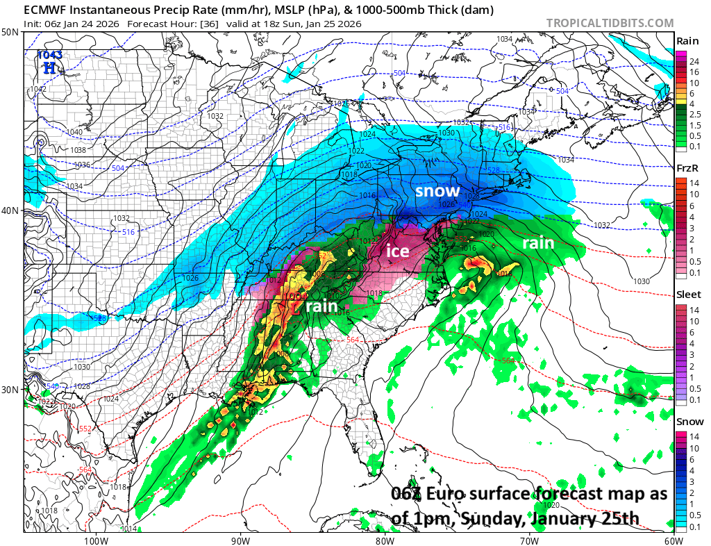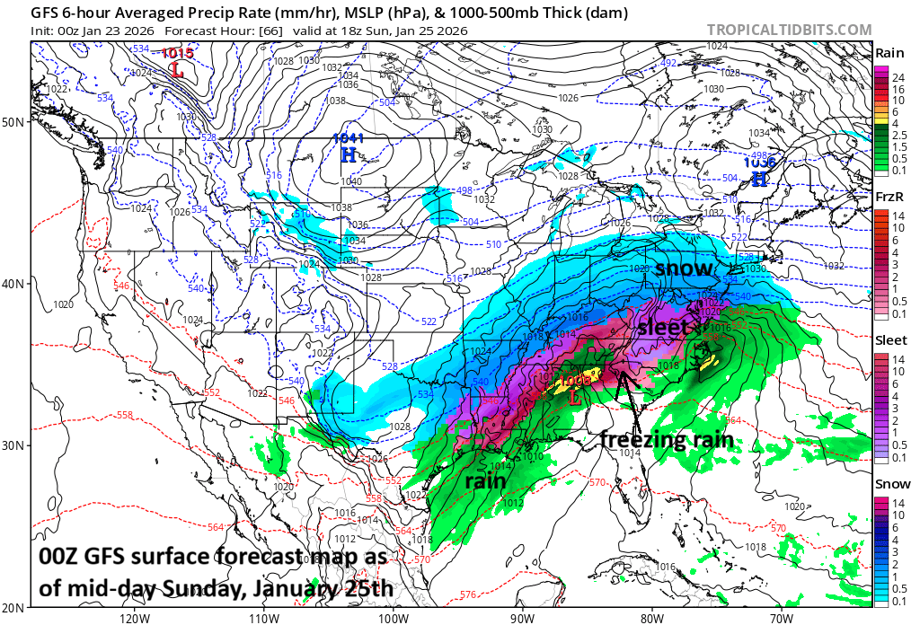
Thursday, April 23rd – *The development of El Nino and the atmospheric response…an increase in severe weather outbreaks…an increase in rain events*
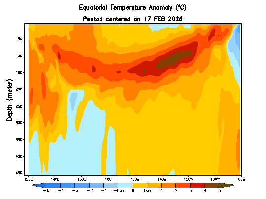
Sub-surface water temperature anomalies (°C) down to a depth of 450 meters are shown here from the equatorial part of the Pacific Ocean in the period from 17 February 2026 to 18 April 2026. Much warmer-than-normal water (shown in orange/brown) is now lurking just beneath the surface (top) across much of the tropical Pacific and …