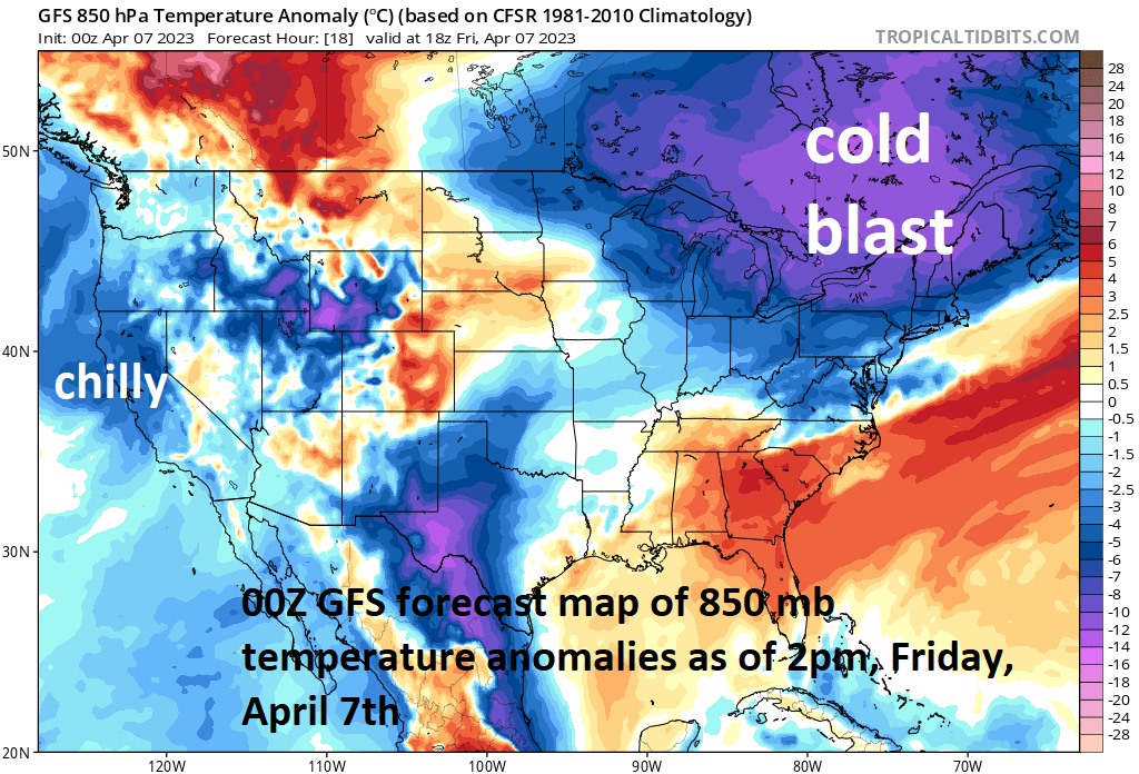

A strong cold frontal system pushed through the eastern states late Thursday and its passage has ushered in a very chilly air mass for this time of year to the Great Lakes/Northeast/Mid-Atlantic. In fact, many parts of the northeastern quadrant of the nation will experience temperatures again dropping to or below the freezing mark during the next few late nights. At the same time, California continues to experience colder-than-normal weather conditions as we end the work week and this type of pattern has been dominant in that part of the nation during the past several weeks.
As a result of the chill, many stadiums in these two parts of the nation will feature low readings for the Home Run Forecast Index (HRFI) for today’s games and likely well into the weekend as well. An HRFI that is low is indicative of unfavorable weather conditions for baseball’s to travel and the following cities in the Great Lakes/Northeast/Mid-Atlantic and California may have values of “1’s” for today’s games (some of which are home openers): New York (Mets), Chicago (Cubs), Baltimore, Philly, Cleveland, Minnesota, Pittsburgh and even San Francisco will be on the low side with an HRFI likely valued at “3”.
Looking ahead, a pattern change will likely bring about a warm air surge into the central and eastern US for the middle and latter parts of next week.
Meteorologist Paul Dorian