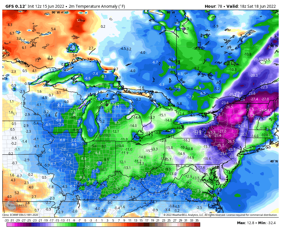

An unusually cool air mass has poured into the Great Lakes/Mid-Atlantic/Northeast US for the middle of June with temperatures as much as 25 degrees below-normal for this time of year. There will be a mix of clouds today in this region and winds will be quite persistent from a northwesterly direction gusting past 35 mph at times. As an example of the unusual nature of this air mass, temperatures will hold near the 70 degree mark this afternoon in Philly and the normal high at PHL is 84 degrees. The cool air mass is keeping a damper on the Home Run Forecast Index (HRFI) at mid-day in many parts of this affected region with “low” values of 1, 2 or 3 in such baseball towns as Chicago, Cleveland, and New York. With a “low” HRFI, the weather conditions will likely inhibit the distance a baseball can travel in this part of the nation. A significant warmup in likely in much of this region by the middle of next week.
(2-meter temperature anomaly forecast map for early Saturday afternoon; map courtesy Weather Bell Analytics, NOAA)
Meteorologist Paul Dorian